
Bike routes in the Empordà: from the flat plain to the Costa Brava viewpoints
Alberto Martínez Martín, editor of bicis.net 4 min read
In this article
The Empordà has something few areas combine: an open plain for easy riding, low ranges to rack up metres and a coastline with viewpoints over the sea. If you're looking for bike routes in the Empordà, here are the ones already measured on bicis.net, from the gentlest to the toughest, with their distance and elevation gain.
Data as of 23 October 2026, from the routes published on bicis.net and the «Routes by province» table in Cycling in figures. Tracks © OpenStreetMap contributors.
The Empordà in figures: what there is to ride
The Empordà is in the province of Girona, one of those with the most routes on the site: 116 routes adding up to 3,058.2 km, with 20 climbs and an average elevation gain of 590 m per route (n = 890 routes in the whole table, data as of 23 October 2026). 28.4 % of those routes are gravel, so there's room to get off the tarmac too.
You can see them all, with their map and profile, in the bike routes in Girona. There you'll also find those in the Gavarres, the Albera and the PirineXus, the longest route in the province.
Four routes through the Empordà, from the gentlest to the toughest
| Route | Type | Km | Elevation gain (m) |
|---|---|---|---|
| Eix cicloturístic Figueres - Roses | Road | 15.5 | 33 |
| 1 - Ruta per la plana de l'Empordà | Road | 44.33 | 376 |
| 3 - Gran volta pel Baix Empordà | Road | 77.24 | 911 |
| 4 - Els miradors de la Costa Brava | Road | 77.18 | 1,222 |
To start with: Figueres - Roses
If you don't have many kilometres in your legs, you're riding with the family or on a leisure e-bike, start with the Figueres - Roses cycle touring route: 15.5 km and just 33 m of elevation gain, from the capital of the Alt Empordà to the sea. It's flat, short and ends at the beach. If you want more, ride there and back.
Half a morning: the plana de l'Empordà
One step up is the route across the plana de l'Empordà: 44.33 km with 376 m of elevation gain. Quiet back roads between fields and stone villages, ideal for an easy ride with a coffee halfway. It's the perfect route to build base fitness without suffering.
A full day: the big loop around the Baix Empordà
The Gran volta pel Baix Empordà goes up to 77.24 km and 911 m of elevation gain. Long, varied and with villages to regroup in, it's the classic group ride in the area. Bring food and water for the whole morning.
For days when your legs are good: the Costa Brava viewpoints
Els miradors de la Costa Brava is the toughest of the four: 77.18 km and 1,222 m of elevation gain, linking short climbs above the sea. Almost the same distance as the big loop, but with a lot more climbing. The views make up for every ramp.
When to ride in the Empordà
Autumn and spring are the best time: mild temperatures and less traffic on the coast. In winter you can ride well almost every day, but watch out for the tramontana: the north wind blows hard on the plain and can turn a flat route into a very serious ride. Plan your loop so you have it at your back at the end, when you're most tired.
In summer, set off early. The coast fills up with cars from mid-morning and the heat bites on the plain, where there's hardly any shade.
What to bring on your Empordà ride
For the short routes on the plain, the usual kit is enough: a bottle, a puncture kit and something warm if you head out early. For the long loops and the viewpoints, think of a ride of four hours or more:
- Two bottles and something to eat every hour. There are villages to stop in, but not always to hand when you need them.
- A light windproof. With the tramontana, it feels much colder on the plain even when the sun is strong.
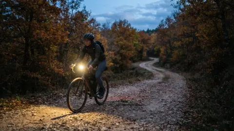
- Lights front and rear. In autumn and winter it gets dark early and the coast has winding sections with poor visibility.
- Easy gears if you're going to the viewpoints: the climbs are short but come one after another, and a big sprocket is welcome.
Gravel, greenways and more: the rest of Girona
If you prefer dirt, the Gavarres, the wooded massif that separates the plain from the coast, have forest tracks for gravel and mountain biking. You'll find them on the Girona routes page.
Not far away you also have the Vía Verde del Carrilet from Olot to Girona: 58.5 km and 195 m of elevation, almost all downhill. It's the province's greenway on bicis.net and an easy way to link the Garrotxa with the Empordà.
And you won't be riding alone: Girona has 174 clubs in the bicis.net directory and 60 businesses between shops and workshops, 10 of them with bike hire (data as of 23 October 2026). If you're coming from elsewhere without your bike, you've got places to hire one.
Frequently asked questions
What's the easiest bike route in the Empordà?
The Figueres - Roses cycle touring route: 15.5 km and 33 m of elevation gain, practically flat and all the way to the sea. It works for any bike and for riding with the family.
What's the toughest route in the Empordà?
Of these four, Els miradors de la Costa Brava: 77.18 km and 1,222 m of elevation gain, with short climbs one after another above the sea.
Can you ride gravel in the Empordà?
Yes. The Gavarres have forest tracks for gravel. Across the province of Girona, 28.4 % of the 116 routes on bicis.net are gravel.
How many bike routes are there in Girona?
116 routes published on bicis.net, with 3,058.2 km in total and 20 climbs, as of 23 October 2026.
When is the best time to ride in the Empordà?
In autumn and spring. You can ride well in winter, but the tramontana can blow hard on the plain: check the wind before you set off.
Sources for this article
- Routes and maps: © OpenStreetMap contributors
Spotted a mistake? Write to us at info@bicis.net and we’ll fix it. Who writes bicis.net and how we work
Comments
What do you think? Create your free account to comment.